The National Hurricane Center is tracking a weather disturbance off the southeastern U.S. coast that could bring increased rain chances to parts of Florida and the Gulf Coast this week.
The system is developing along a stalled frontal boundary near the Florida coast. Forecasters currently give it a low chance of organizing into a tropical cyclone over the next several days.
Dry air and wind shear are expected to limit significant strengthening.
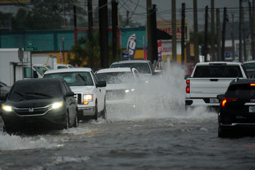
Even if the disturbance does not become a named storm, it could still produce periods of heavy rainfall as it drifts westward.
Meteorologists note the main concern would be localized flooding rather than strong winds at this stage.
The system sits well outside the typical peak of hurricane season, which aligns with NOAA’s earlier forecast for a below-normal 2026 Atlantic season overall.
No tropical cyclones are currently active in the Atlantic basin.
If development occurs, the next name on the list would be Bertha. Residents along the Florida peninsula and Gulf Coast should monitor updates through the week as the pattern evolves.
Meteorologist Eric Burris of WESH says that the storm only has a 10 percent chance of development through seven days.
Burris notes that conditions will become less favorable later on in the week, but that the system is “disorganized.”
Florida will most likely just receive rain and isn’t facing a significant threat.
It could still dampen Fourth of July weekend, but probably won’t be too serious.