As Independence Day approaches, forecasters at the National Weather Service’s Weather Prediction Center remain vigilant, issuing timely alerts to protect travelers and residents enjoying the holiday period.
While July often features intense thunderstorms and powerful gusts, this year has introduced an unexpected twist with wintry conditions appearing in parts of the country. This unusual blend of summer and winter weather has caught many off guard, creating a striking contrast during what should be peak warm-season activities.
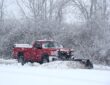
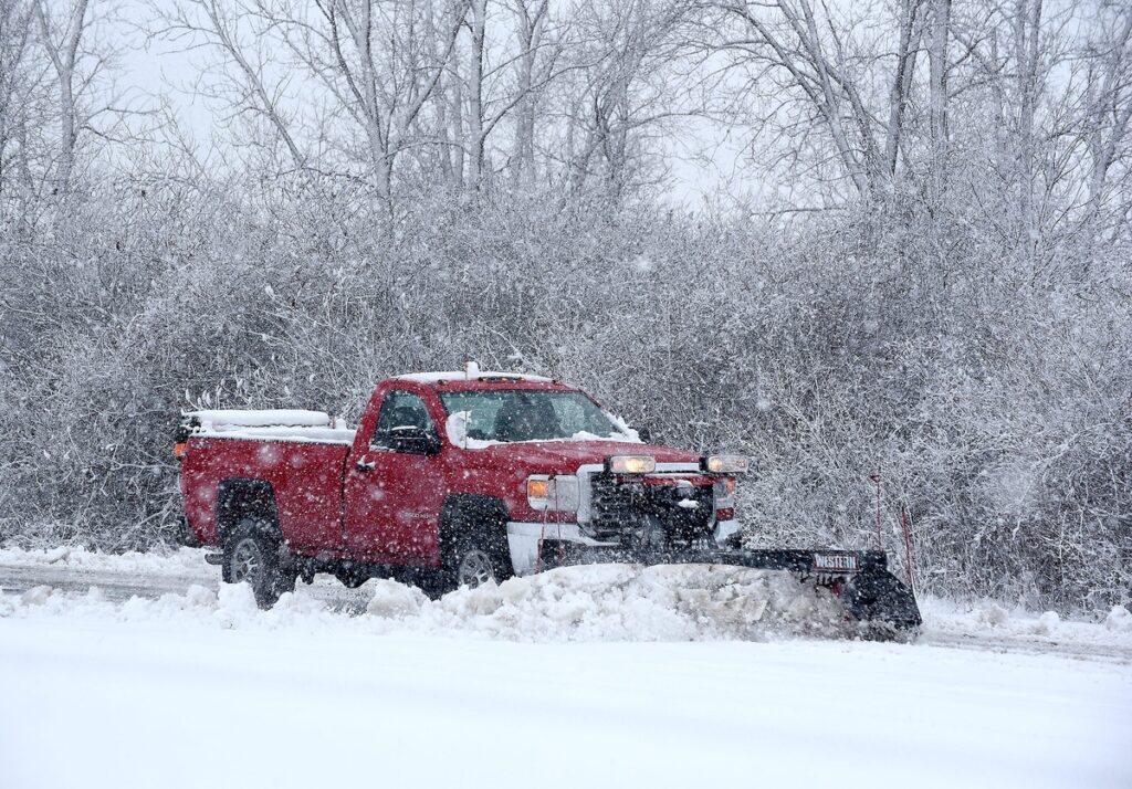
Recent storms have delivered significant snowfall in mountainous regions, particularly in the West. One area in Jackson, Montana, recorded 16 inches of accumulation from the system that intensified over the weekend. Experts indicate that additional snow could push totals closer to 18 inches in some spots, adding a layer of complexity to holiday plans in typically milder locales.
Nearby in eastern Idaho, communities in Lemhi County experienced four to eight inches of heavy, wet snow. Such accumulations at this time of year highlight the erratic nature of the current atmospheric setup, where cold air intrusions have overridden the usual summer warmth in higher terrain.
Authorities have urged caution for those heading into elevated zones within western national parks. The National Weather Service has highlighted winter-like conditions in these spots, especially around popular destinations. Travelers should take note of advisories affecting key routes, including U.S. 20 over Targhee Pass, the primary access point to the bustling west entrance of Yellowstone National Park.
Broader temperature patterns have contributed to this rare summer snowfall. The Guardian noted the persistence of chilly air across a wide swath of the western United States.
“Temperatures from the Canadian border to California have widely been 5-10C below the norm since Friday, and more than 10C below in some parts farther north. The pattern is expected to remain for much of the coming week.”
Despite the dramatic scenes of snow, the bulk of the wintry activity has begun to taper off. Residual effects from the storm linger, but the most intense warnings have subsided. Isolated pockets of additional snow remain possible, primarily at elevations exceeding 7,000 feet across the Northwest and Northern Rockies on Thursday, July 2, and Friday, July 3, according to updates from NOAA’s Weather Prediction Center.
This variability extends beyond frozen precipitation. Other regions are contending with strong winds that could lead to hazardous situations. In particular, forecasters have zeroed in on west Michigan as a focal point for severe conditions late Thursday. Research shared by storm tracking enthusiasts points to “Models have actually been in agreement on the location of the most-likely impact area being west Michigan late Thursday. Damaging winds of 60-70 mph will be possible, along with some instances of large hail.”
The combination of these elements paints a complex picture for the holiday weekend. While much of the nation basks in typical summer warmth, pockets of the West and Midwest face reminders of colder seasons. This juxtaposition serves as a powerful illustration of how quickly weather patterns can shift, even in the heart of July.
Residents and visitors alike are encouraged to monitor local forecasts closely before embarking on outdoor adventures or long drives. Preparation remains key, whether that means packing extra layers for mountain excursions or securing loose items ahead of windy conditions. The active pattern underscores the importance of staying informed through reliable sources like the National Weather Service.
Ultimately, this atypical July weather adds an element of surprise to Independence Day celebrations. It reinforces the need for flexibility in plans and respect for nature’s unpredictability.
As the holiday unfolds, safety advisories will continue to play a crucial role in helping Americans navigate everything from potential snow flurries to gusty storms.