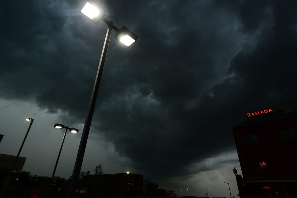
The National Weather Service has issued alerts for residents across eight states in advance of what could become a day of powerful thunderstorms on Sunday, July 5. Forecasters are highlighting the risk of intense electrical activity, including frequent lightning strikes, accompanied by other hazardous conditions.
Communities in various regions should prepare for sudden shifts in weather that may disrupt outdoor plans and daily routines.
Experts indicate that the storms could bring not only thunder and lightning but also torrential downpours, strong gusts, and the possibility of sizable hail. These elements combine to create dangerous situations for those caught unprepared. The forecast marks a notable departure from the previous day’s conditions, underscoring how quickly weather patterns can evolve in the summer months.
July 4 remained largely tranquil for much of the nation, allowing many Americans to enjoy holiday celebrations without major interruptions from the elements. However, that stability is expected to give way to more volatile atmospheric activity on July 5.
Meteorologists urge vigilance as the day progresses, particularly in areas where storm development may occur rapidly.Officials have placed the following states on notice for potential severe weather impacts: Texas, North Dakota, Pennsylvania, West Virginia, Virginia, Maryland, Delaware, and New Jersey.
The broad geographic spread of these alerts covers regions from the southern plains through the mid-Atlantic, affecting millions of residents who may need to adjust their schedules accordingly.
Stay informed by monitoring local news stations or a NOAA Weather Radio for the most current information on severe thunderstorm watches and warnings. This ongoing awareness allows you to respond quickly as conditions change.
When at home and a severe thunderstorm warning is issued, move immediately to your designated safe area inside the house. Strong winds or large hail may arrive soon, so bring your pets with you if there is time.
At work or school during an active warning, keep away from windows to avoid risks from damaging winds or hail. Avoid gathering in expansive open spaces such as cafeterias, gymnasiums, or auditoriums, which can become hazardous.
If you are outdoors and severe thunderstorms are nearing, enter a sturdy, permanent building right away. Avoid using sheds or storage structures for shelter, as they offer little protection. Never stand under a tree, since falling limbs can cause injury and the location increases the chance of a direct lightning strike.
While inside a vehicle, you are generally safer than being exposed outside during a thunderstorm. Still, drive to the nearest secure shelter whenever possible if conditions allow safe travel.
By heeding these guidelines and monitoring updates closely, communities can minimize risks associated with the incoming storms. Public awareness and timely response will play a vital role in ensuring a safe transition through this period of unsettled weather.