A Tornado Watch is active for the entirety of central Indiana and will continue through 1 a.m. Thursday morning. Residents across the region should stay alert as conditions are expected to deteriorate rapidly with the approach of a strong cold front.
Earlier in the day, widespread cloud cover combined with scattered showers held temperatures in the 70s across much of the state. While these conditions provided some relief from hotter weather, forecasters warn that the real concern lies ahead with the arrival of potent thunderstorms this evening.
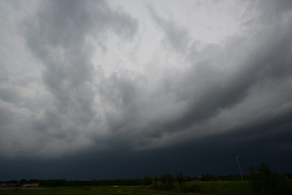
The northwest portion of Indiana, including the Indianapolis metropolitan area, faces a Moderate Risk for severe weather. West-central parts of the state carry the highest potential for tornado development tonight, making vigilance especially important in those communities.
Strong and severe storms are already moving through neighboring Illinois, where a Tornado Watch covers most of the state until 11 p.m. These systems have already produced damaging winds exceeding 60 miles per hour along with large hail and isolated tornadoes during the afternoon hours.
Tonight’s incoming storms are forecast to be more intense and widespread compared to the activity that crossed the state on Tuesday night. Thunderstorms are expected to push into northwest Indiana after 7 p.m., with coverage increasing and spreading east-southeastward once the sun sets.
All types of severe weather remain possible as the system advances, ranging from tornadoes and large hail to destructive straight-line winds. Heavy rainfall will also accompany the storms, raising the risk of flash flooding in many locations.
Between one and two inches of rain are anticipated for much of the affected area, with isolated spots potentially seeing up to four inches. In response, a Flood Watch has been issued for most of Indiana, and the bulk of the precipitation should exit the state by around 2 a.m.
Now is the ideal time for residents to finalize their severe weather preparations. Ensure all electronic devices are fully charged in case of power outages, and review or establish a family safety plan for when warnings are issued in your area.
The weather channels will continue providing live updates and timely information as the event unfolds throughout the night. Staying informed through reliable local sources will be crucial for making safe decisions.
Once the cold front moves through overnight, conditions will improve significantly by Thursday morning. Skies are expected to clear, leading to a stretch of sunny weather with daytime highs near 80 degrees from Thursday through Saturday.
The next opportunity for rainfall is not anticipated until Sunday afternoon.