Meteorologists are closely monitoring developing weather systems that could bring dangerous conditions across parts of the central United States today. The National Weather Service has issued alerts indicating that significant hailstorms may impact roughly half a dozen states on Thursday, May 14, with the potential for widespread disruption and property damage.
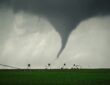
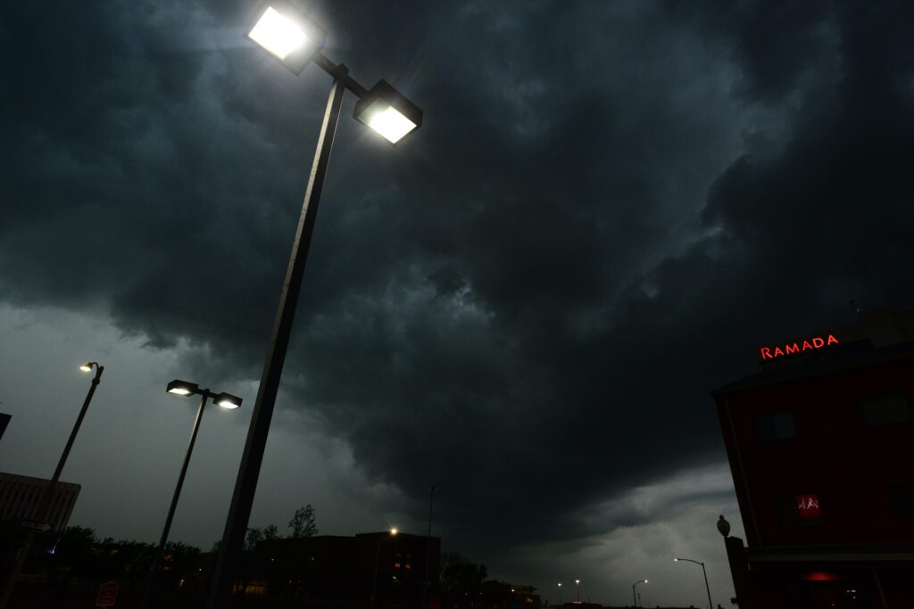
Forecasters highlight a corridor of atmospheric instability capable of producing intense thunderstorms. These storms are expected to generate large hailstones, powerful wind gusts, frequent lightning, and thunder. In some isolated instances, the conditions could also spawn one or two tornadoes, adding another layer of concern for residents in vulnerable regions.
The states facing the highest risk include Kansas, Oklahoma, Nebraska, Iowa, Missouri, and Illinois. Communities in these areas should prepare for possible sudden onset of severe weather, as storms could develop rapidly during the afternoon and evening hours. Officials urge everyone to remain vigilant and review their emergency plans.
Hail of significant size poses a particular threat, capable of shattering windows, denting vehicles, and damaging roofs and agricultural crops. Accompanying strong winds may further exacerbate the situation by downing tree limbs or power lines, leading to outages and hazardous debris in roadways.
Lightning activity is another key element of these storms, presenting risks both to people outdoors and to electrical infrastructure. Thunderstorms of this magnitude often move quickly, meaning conditions can deteriorate with little advance notice in affected locales.
Safety Guidelines During Severe Thunderstorm Threats
Authorities emphasize the importance of staying informed through reliable channels. Continue to listen to local news broadcasts or a NOAA Weather Radio to stay updated about severe thunderstorm watches and warnings.
When at home, go to your secure location if you hear a severe thunderstorm warning. Damaging wind or large hail may be approaching. Take your pets with you if time allows.
In workplaces or schools, stay away from windows if you are in a severe thunderstorm warning and damaging wind or large hail is approaching. Do not go to large open rooms such as cafeterias, gymnasiums or auditoriums.
For those caught outside, seek shelter inside a sturdy building immediately if severe thunderstorms are approaching. Sheds and storage facilities are not safe. Taking shelter under a tree can be deadly. The tree may fall on you. Standing under a tree also puts you at a greater risk of getting struck by lightning.
While traveling in a vehicle, being in a vehicle during severe thunderstorms is safer than being outside; however, drive to closest secure shelter if there is sufficient time.
Experts recommend that households assemble or review their emergency kits, which should include flashlights, batteries, bottled water, and non-perishable food items. Charging electronic devices ahead of time can ensure access to information if power is lost.
Local emergency management offices in the listed states are coordinating with the National Weather Service to provide real-time updates through social media and alert systems. Residents are encouraged to sign up for wireless emergency alerts on their mobile phones.
As the day progresses, conditions may evolve, so flexibility and awareness will be essential. Even areas on the edges of the primary risk zone could experience gusty winds or smaller hail, warranting caution.
By following these precautions and heeding official warnings, individuals can significantly reduce their exposure to the dangers posed by today’s potential severe weather outbreak.
Staying prepared remains the most effective defense against nature’s unpredictable forces.