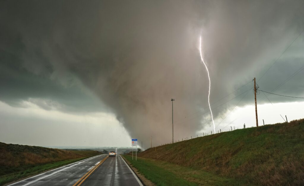
Meteorologists at the National Weather Service have issued alerts indicating that residents in several parts of the Midwest should prepare for possible tornado activity on Wednesday. This outlook highlights the potential for severe weather to develop across a broad region, urging communities to stay vigilant as conditions could shift rapidly throughout the day.
According to the latest Severe Weather Outlook, six states face a low but notable probability of tornado impacts, estimated between 2 and 5 percent. While these percentages may appear small, experts emphasize that even slim chances warrant serious attention, especially given the destructive power of such storms when they do form.
The states included in this alert are South Dakota, Nebraska, Minnesota, Iowa, Wisconsin, and Michigan. These areas span a significant portion of the northern Midwest, where atmospheric conditions have aligned in a way that could spawn isolated severe thunderstorms capable of producing twisters.
Forecasters continue to monitor developing weather patterns that might increase risks as the day progresses. Residents in these locations are encouraged to review their emergency plans early and ensure access to reliable information sources, since timely updates can make a critical difference in personal safety.
Tornadoes remain among nature’s most unpredictable hazards, often forming with little advance notice. In regions like the Midwest, where open landscapes and variable weather systems frequently interact, preparedness becomes essential for minimizing harm to lives and property.
As a reminder, here’s what to do when tornadoes strike.
Stay Weather-Ready: Continue to listen to local news or a NOAA Weather Radio to stay updated about tornado watches and warnings.
At Your House: If you are in a tornado warning, go to your basement, safe room, or an interior room away from windows. Don’t forget pets if time allows.
At Your Workplace or School: Follow your tornado drill and proceed to your tornado shelter location quickly and calmly. Stay away from windows and do not go to large open rooms such as cafeterias, gymnasiums, or auditoriums.
The guidance extends to those caught outdoors or on the road, situations that demand quick decision-making. Taking the proper steps can help individuals avoid exposure to flying debris and extreme winds associated with these events.
Outside: Seek shelter inside a sturdy building immediately if a tornado is approaching. Sheds and storage facilities are not safe. Neither is a mobile home or tent. If you have time, get to a safe building.
In a vehicle: Being in a vehicle during a tornado is not safe. The best course of action is to drive to the closest shelter. If you are unable to make it to a safe shelter, either get down in your car and cover your head, or abandon your car and seek shelter in a low lying area such as a ditch or ravine.
Local officials and emergency management teams in the affected states are coordinating efforts to spread awareness about these protocols. Families and businesses alike should take time to identify the safest spots in their immediate environments well before any warnings are issued.
Even with advanced forecasting tools available today, the unpredictable nature of severe weather means that personal readiness remains the most effective defense. By heeding the National Weather Service advisory and internalizing these safety measures, communities across the Midwest can better protect themselves during this period of elevated risk.
As Wednesday unfolds, staying informed through official channels will be key. Should conditions escalate beyond current projections, additional alerts could follow, reinforcing the need for ongoing attention to weather developments in the region.